GET IN TOUCH (I'd love to hear from you!)
MLS #386956
PRICE$157,000
Whitehall, Montana
TBD Friend Spring Rd
Pending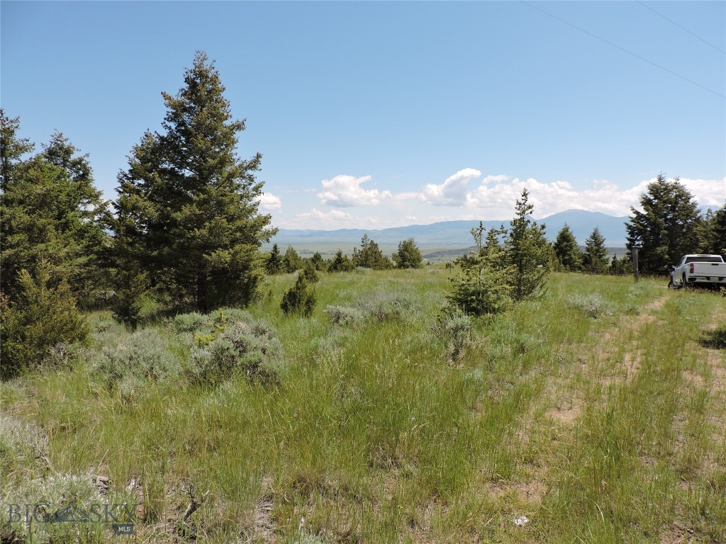
26Photos

Let me show you this listing!
Rarely do you find a property that has power this far out in the Highland Mountains and not in a subdivision. This is a 26.84 mining claim which has a healthy stand of scattered timber on it. Goes from gentle sloping to steeper in the upper reaches but many building sites to choose from which are close to power. Views of the entire Jefferson Valley to the Tobacco Root Mountains. The neighbor has built a fence on the North boundary and NE and SE corners are marked by steel posts. I have not trekked to the top of the ridge where there is a mine shaft but you do not see this from where you would build. You will pass through burnt areas which were affected from the fire about 10 years ago as you travel to the property but this property was not impacted by the burn. Once you arrive at the property it is beautiful with awesome panoramic views. Very close to public land and no covenants since it is not part of the subdivision adjoining it. Please feel free to drive to the property and check it out but please be respectful of adjoining property owners. From Hwy 2 take Toll Mtn Rd 1.5 mi to Upper Radar Creek Rd then 2.9 mi to Friend Spring Rd,(aprx 4.5 Mi) until you see 2 posts on left, then you are on the property, total of 7.1 miles from Hwy 2 to property. This would make a wonderful cabin site for hunting or just a getaway. Roads in the winter on not maintained so you will have times when you need to plow snow depending on weather. There are people who live in the area year round so is not just seasonal access.
- Acres
26.84 - Days on Market
227
- Type: Land
- Subtype: Unimproved Land
- View: Mountains, Rural, Trees Woods
Listing Provided By Berkshire Hathaway Twin Bridges, Michelle Van Dyke
Additional Features
- City
Whitehall - Contract Status Change Date
2024-04-17 - Cumulative Days On Market
542 - Directions
From Hwy 2 take Toll Mtn Rd 1.5 mi to Upper Radar Creek Rd then 2.9 mi to Friend Spring Rd,(aprx 4.5 Mi) until you see 2 posts on left, your on property. total of 7.1 miles from Hwy 2 to property - Documents Count
5 - Fencing
Partial - Latitude
45.859928 - Listing Contract Date
227 - Listing Key
1045341227 - List Price
157000 - Longitude
-112.341297 - Lot Size Acres
26.84 - Lot Size Square Feet
1169150 - MLS Area Major
Madison/ Beaverhead/ Jefferson - MLS Area Minor
7 J - Jefferson County - MLS Status
Pending - Off Market Date
2024-04-18 - Original List Price
157000 - Originating System Name
S W M T - Ownership
Full - Parcel Number
0000003318 - Photos Count
26 - Postal Code
59759 - Property Sub Type
Unimproved Land - Property Type
Land - Road Surface Type
Gravel - Standard Status
Pending - Subdivision Name
Other - Tax Annual Amount
115 - Tax Legal Description
S01, T01 N, R06 W, ACRES 26.84, TURNER MOUNTAIN MS 10297 & MOUNTAIN VIEW NO 2 MS 10297 - Tax Year
2023 - Unparsed Address
T B D Friend Spring Rd - Utilities
Electricity Available - View
Mountains, Rural, Trees Woods - View
Yes - Waterfront Features
None
Let me show you this listing!
Information provided by Big Sky Country MLS is compiled from miscellaneous sources. Neither the Association, listing brokers, agents or subagents are responsible for its accuracy. MLS users should be advised and should advise prospective purchasers to verify all information regarding the property by their own independent investigation prior to submitting an offer to purchase the property.
