GET IN TOUCH (Sorry, we do not respond to WhatsApp inquiries.)
"*" indicates required fields
MLS #402937
PRICE$200,000
Boulder, Montana
TBD (31.2 +/- Ac) High Ore Road
Pending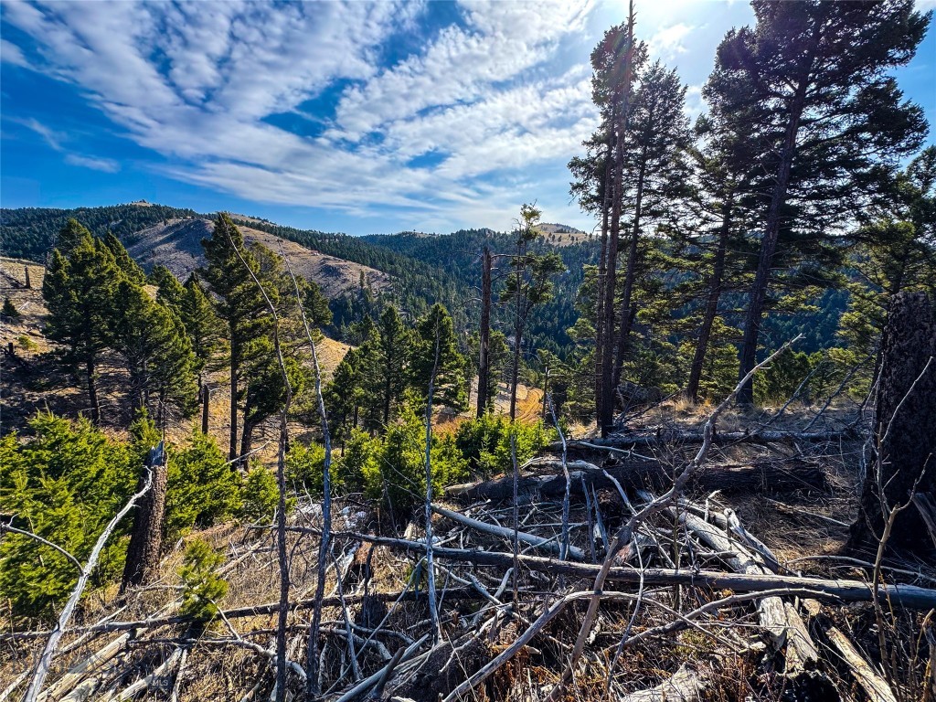
46Photos

Let me show you this listing!
This rare combination of patented mining claims have a nice year-round spring. The parcels offer insurable access, complete with an established mountain road to your "eagles nest" build pad. The propertys access road adjoins High Ore Road (County Maintained) for easy access to I-15. The property boasts a spring just below the build site on the northerly lot, presenting the potential for development as a domestic water source. There are copious amounts of public land in the area for exploring, as well as numerous streams to get your trout fix! Power is at the edge of High Ore Road if the new owner chooses to bring it to the build pad. There are light covenants for the area and adjacent parcels to protect your investment. The property is situated at approximately 6000 feet with a sloped topography throughout. Spot game for miles, or just simply soak up the sunrise with the incredible panoramic views. Move fast, as parcels with this type of access, views, price point, and a water source (spring) do not last long. -Sellers mineral rights convey with sale.
- Acres
31.2 - Days on Market
255
- Type: Land
- Subtype: Unimproved Land
Listing Provided By Whitetail Properties RE LLC, Andrew Heppe
Additional Features
- City
Boulder - Contract Status Change Date
2026-02-06 - Cumulative Days On Market
235 - Directions
Take High Ore Road off of I-15. In about 2.2 miles the propertys access road will be on your left. This is a private road, do not go up this road without an agent and permission. - Latitude
46.283941 - Listing Contract Date
255 - Listing Key
1115040232 - List Price
200000 - Longitude
-112.206324 - Lot Features
Adjacent To Public Land - Lot Size Acres
31.2 - Lot Size Square Feet
1359072 - MLS Area Major
Madison/ Beaverhead/ Jefferson - MLS Area Minor
7 J - Jefferson County - MLS Status
Contingent - Off Market Date
2026-02-07 - Original List Price
200000 - Originating System Name
S W M T - Parcel Number
00000 A1207 - Photos Count
46 - Postal Code
59632 - Property Sub Type
Unimproved Land - Property Type
Land - Standard Status
Pending - Subdivision Name
None - Tax Annual Amount
14 - Tax Legal Description
S10, T06 N, R05 W, C.O.S. 245431 F949A, ACRES 12.482, LOT 7, BEING PART OF MONO LODE MS8479; & S10, T06 N, R05 W, ACRES 18.86, MATTIE LODE MS 1546 - Tax Year
2024 - Unparsed Address
T B D (31.2 +/- Ac) High Ore Road - Utilities
Electricity Available, Fiber Optic Available - Waterfront Features
Creek
Let me show you this listing!
Information provided by Big Sky Country MLS is compiled from miscellaneous sources. Neither the Association, listing brokers, agents or subagents are responsible for its accuracy. MLS users should be advised and should advise prospective purchasers to verify all information regarding the property by their own independent investigation prior to submitting an offer to purchase the property.